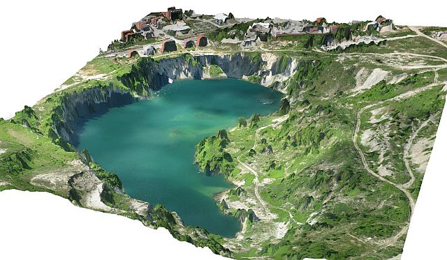
The Vihovici coal mine is located in the heavily industrialized Mostar Valley, Bosnia and Herzegovina. The mine was exploited by a state-owned company, but has been inactive since 1991.
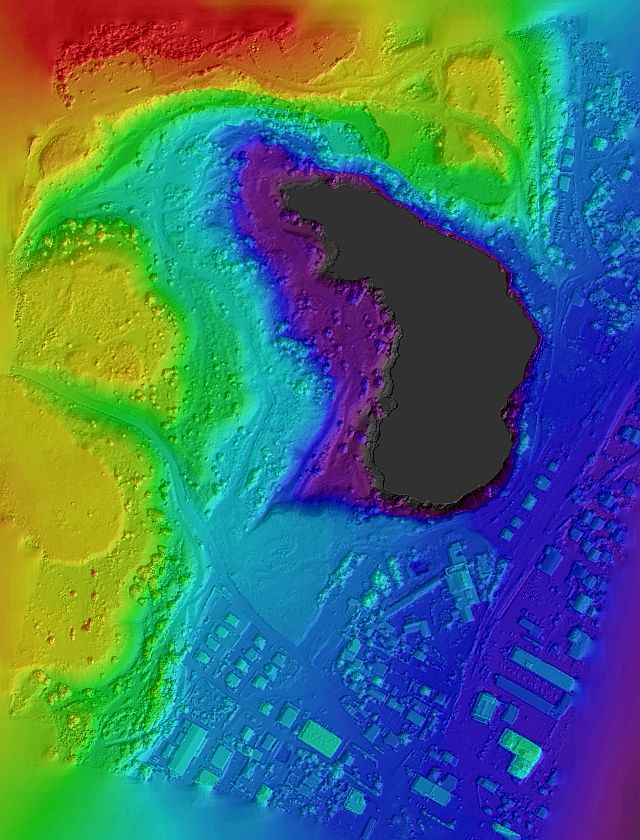
As part of the EU-FP7 IMPACTMIN study, this area was investigated using a combination of remote sensing data (Satellite imagery, UAV technology, airborne hyperspectral imagery, gammaray data) and a variety of field data, including spectral measurements on soils and rocks.
The area exhibits in many ways very high levels of risk to the environment and local population. The aim of the study was:
Monitoring the stability of the pit-wall.
Detection and delineation of underground coal fires which can spread to the dumpsites or cause chemical reactions producing hazardous gases. The burning of the coal also destabilizes the steep slopes even more.
Delineation of the horizontal and vertical extend of the landfill. The mine was used as public solid waste dump during the 1992-1995 war. Illegal waste dumping still continues. There are reports of radioactive waste dumped in the area before, during and after the war.
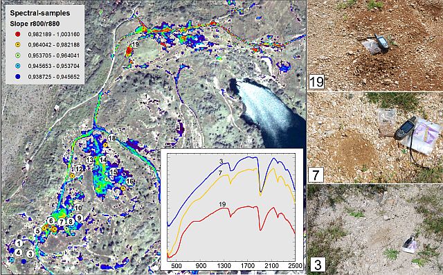
Inspection of sewerage and discharge systems, wich are generally in poor conditions.
Determination of the grade and extend of soil and groundwater pollution. Waterborne pollutants are a serious concern for the environment and public health.
Detection and delineation of other landfills in the vicinity of the mine. Large quantities of waste are reportedly being dumped illegally at roadsides, rivers, abandoned mines (including Vihovici), posing a threat to public health and the environment.
Top: 3-D model of the Vihovici open pit mine Middle: Digital elevation model of the Vihovici open pit area Bottom: Example of spectral mapping of polluted soils. The inset shows some examples of reflectance spectra of soils at different locations. The numbers refer to the sample locations on the image.